Compare Trail Ultra Marathon Races
|
Race Name
|
Beacons Way Ultra 100 Mile Ultra Marathon Race by GB Ultras in July |
The Winter Spine Race 268 Mile Non Stop Ultra Marathon Race near Pennine Way in January |
| Landscape |
|

|
| Difficulty Score |
297.92
|
644.71
|
| Distance |
158km
|
418km
|
| Elevation |
6324metres
|
11628metres
|
| kilometer effort |
226km-effort
|
520km-effort
|
| General Info |
General Info
|
General Info
|
| Month |
July
|
January
|
| Organiser |
GB Ultras
|
|
| Town/City |
Abergavenny
|
Kirk Yetholm
|
| County State |
Powys
|
Yorkshire
|
| Country |
Wales, United Kingdom
|
England, United Kingdom
|
| Continent |
Europe
|
Europe
|
| National Park Name |
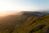
Brecon Beacons
|
Peak District, Yorkshire Dales, Northumberland
|
| Distance and Elevation |
Distance and Elevation
|
Distance and Elevation
|
| GPX File |
beacons way 100 mile ultra marathon race by gb ultras route gpx
|
winter spine race route gpx
|
| Ground Type |
trail
|
off trail, trail
|
| Elevation Type |
mountainous
|
mountainous
|
| Lowest Elevation |
40metres
|
106metres
|
| Max Elevation |
880metres
|
890metres
|
| Elevation Profile |
|
|
| Elevation Per KM |
40m/km
|
28m/km
|
| Average Altitude |
400metres
|
300metres
|
| Distance Type |
160km / 100 miles
|
400km / 250 miles
|
| Steepest Downhill Amount |
31%
|
40%
|
| Steepest Hill |
40%
|
38%
|
| Uphill Amount |
49%
|
46%
|
| Flat Amount |
6%
|
8%
|
| Downhill Amount |
45%
|
46%
|
| Trajectory Difference |
0 metres
|
-102 metres
|
| Trajectory |
same
|
down hill
|
| Climbing |
Climbing
|
Climbing
|
| Categorised Climb Amounts |
19
|
35
|
| Categorised Climb Every KM |
8km
|
12km
|
| Categorised Climbs Total Length |
42.80km
|
69.70km
|
| Average Categorised Climb Length |
2.00km
|
1.99km
|
| Percent of Race Categorised Climbs |
23%
|
17%
|
| Average Categorised Climb |
3.00/4
|
3.60/4
|
| Categorised Biggest Climb Length |
3.80km
|
4.60km
|
| Cat Biggest Climb Elevation |
389metres
|
554metres
|
| Average Categorised Climb Elevation |
226metres
|
160metres
|
| Navigation and Route |
Navigation and Route
|
Navigation and Route
|
| Direction Type |
a to b
|
a to b
|
| Navigation Type |
fully marked course, waymarked in sections
|
waymarked in sections
|
| Mountain Ranges |
Brecon Beacons
|
|
| Long Distance Route |
|
|
| Timing and Cut-offs |
Timing and Cut-offs
|
Timing and Cut-offs
|
| Days |
2
|
7
|
| Days Type |
multi day non stop
|
multi day non stop
|
| Start Time |
morning
|
morning
|
| Finish Cut-Off Time |
40hours
|
168hours
|
| Time Between CPs |
4 hours
|
23 hours
|
| Time of Day |
day and night time
|
day and night time
|
| Time of Week |
weekend
|
mid week
|
| Pace Speed to Finish |
4.12kmh
|
2.49kmh
|
| Checkpoints and Support |
Checkpoints and Support
|
Checkpoints and Support
|
| Support Types |
checkpoints - aid stations
|
checkpoints - aid stations, drop bag, no support, sleep stations
|
| Checkpoints Amount |
10
|
7
|
| Checkpoints /100km |
6.30checkpoints/100km
|
1.60checkpoints/100km
|
| Checkpoints Distance |
16km
|
59km
|
| Sleep Type |
|
indoors
|
| Environmental Conditions |
Environmental Conditions
|
Environmental Conditions
|
| For The Trail |
|
|
| Average Temp |
16c
|
2c
|
| Temperature |
warm
|
freezing
|
| Biodiversity Ranking |
142/201
|
142/201
|
| Season |
summer
|
winter
|
| Participants and Entry |
Participants and Entry
|
Participants and Entry
|
| UTMB Stones |
0 stones
|
0 stones
|
| Participant Amount |
100
|
125
|
| Entry Type |
pay to race, instalments
|
instalments, pay to race
|
| Entry Fee |
£257
|
£1345
|
| Entry Fee Per KM |
£1.62/km
|
£3.21/km
|
| Average Yearly Price Increase |
|
|
| Performance and Difficulty |
Performance and Difficulty
|
Performance and Difficulty
|
| DNF Rate |
20%
|
49%
|