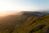
| Landscape |
|

|
| Difficulty Score |
510.61
|
|
| Distance |
320km
|
477km
|
| Elevation |
9171metres
|
20618metres
|
| kilometer effort |
411km-effort
|
683km-effort
|
| General Info |
General Info
|
General Info
|
| Month |
May
|
July
|
| Organiser |
Wild Horse 200
|
Stable Adventures
|
| Town/City |
Chepstow
|
Conwy
|
| County State |
Powys
|
Conwy, Glamorgan, Gwynedd, Cardiff, Caerphilly, Monmouthshire, Torfaen, Powys, Carmarthenshire, Ceredigion, Gwynedd
|
| Country |
Wales, United Kingdom
|
Wales, United Kingdom
|
| Continent |
Europe
|
Europe
|
| National Park Name |
Brecon Beacons
|
Eryri / Snowdonia, Brecon Beacons
|
| Distance and Elevation |
Distance and Elevation
|
Distance and Elevation
|
| GPX File |
wild horse 200 south wales ultra marathon race route gpx file
|
calon lan 300 ultra marathon race route gpx
|
| Ground Type |
trail
|
trail
|
| Elevation Type |
mountainous
|
mountainous
|
| Lowest Elevation |
3metres
|
0metres
|
| Max Elevation |
805metres
|
1071metres
|
| Elevation Profile |
|
|
| Elevation Per KM |
29m/km
|
43m/km
|
| Average Altitude |
300metres
|
300metres
|
| Distance Type |
320km / 200 miles
|
480km / 300 miles
|
| Steepest Downhill Amount |
33%
|
40%
|
| Steepest Hill |
35%
|
40%
|
| Uphill Amount |
45%
|
45%
|
| Flat Amount |
10%
|
6%
|
| Downhill Amount |
44%
|
48%
|
| Trajectory Difference |
53 metres
|
0 metres
|
| Trajectory |
up hill
|
same
|
| Climbing |
Climbing
|
Climbing
|
| Categorised Climb Amounts |
30
|
75
|
| Categorised Climb Every KM |
10km
|
6km
|
| Categorised Climbs Total Length |
57.60km
|
122.00km
|
| Average Categorised Climb Length |
1.92km
|
1.64km
|
| Percent of Race Categorised Climbs |
19%
|
26%
|
| Average Categorised Climb |
3.63/4
|
3.39/4
|
| Categorised Biggest Climb Length |
4.90km
|
3.50km
|
| Cat Biggest Climb Elevation |
433metres
|
577metres
|
| Average Categorised Climb Elevation |
165metres
|
202metres
|
| Navigation and Route |
Navigation and Route
|
Navigation and Route
|
| Direction Type |
a to b
|
a to b
|
| Navigation Type |
map and compass required, not waymarked
|
map and compass required, waymarked in sections
|
| Mountain Ranges |
Black Mountains, Brecon Beacons
|
eryri / snowdonia, Rhinogs, Brecon Beacons, Mynyddoedd Du / Black Mountains, Cambrian Mountains
|
| Long Distance Route |
Wales Coast Path 1400km Long Distance Trail
|
|
| Timing and Cut-offs |
Timing and Cut-offs
|
Timing and Cut-offs
|
| Days |
5
|
7
|
| Days Type |
multi day non stop
|
multi day non stop
|
| Start Time |
morning
|
dawn
|
| Finish Cut-Off Time |
120hours
|
180hours
|
| Time Between CPs |
3 hours
|
16 hours
|
| Time of Day |
day and night time
|
day and night time
|
| Time of Week |
mid week
|
mid week
|
| Pace Speed to Finish |
2.66kmh
|
2.65kmh
|
| Checkpoints and Support |
Checkpoints and Support
|
Checkpoints and Support
|
| Support Types |
checkpoints - aid stations, sleep stations, pacer allowed, drop bag
|
checkpoints - aid stations, crew allowed, drop bag, pacer allowed, sleep stations
|
| Checkpoints Amount |
9
|
11
|
| Checkpoints /100km |
2.80checkpoints/100km
|
2.30checkpoints/100km
|
| Checkpoints Distance |
35km
|
43km
|
| Sleep Type |
indoors
|
|
| Environmental Conditions |
Environmental Conditions
|
Environmental Conditions
|
| For The Trail |
|
|
| Average Temp |
8c
|
17c
|
| Temperature |
cold
|
warm
|
| Biodiversity Ranking |
142/201
|
142/201
|
| Season |
spring
|
summer
|
| Participants and Entry |
Participants and Entry
|
Participants and Entry
|
| UTMB Stones |
0 stones
|
0 stones
|
| Participant Amount |
100
|
150
|
| Entry Type |
pay to race, instalments
|
application, instalments, pay to race
|
| Entry Fee |
£546
|
£849
|
| Entry Fee Per KM |
£1.70/km
|
£1.77/km
|
| Average Yearly Price Increase |
5.5%
|
0.0%
|
| Performance and Difficulty |
Performance and Difficulty
|
Performance and Difficulty
|
| DNF Rate |
20%
|
0%
|