Compare Trail Ultra Marathon Races
- Compare Races: RWC Pembrokeshire Coastal Race 100 Miles, The Lap 74km Around Windermere
- (-) RWC Pembrokeshire Coastal Race 100 Miles
- (-) The Lap 74km Around Windermere
How To Use This Web App
- Click the drop down above, search for or select your first trail and ultra race you want to compare
- The page will reload, now select a second, third and up to four races
- Now head to the table below and compare each trail and ultra race side by side
| Race Name | Run Walk Crawl 100 Mile Pembrokeshire Coast Path Ultra Marathon Race in June | The Lap 74km Ultra Marathon Around Lake Windermere in May and September in the Lake District |
|---|---|---|
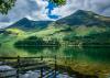
| Landscape |

|
|
| Difficulty Score | 266.90 | |
| Distance | 160km | 74km |
| Elevation | 5520metres | 2543metres |
| kilometer effort | 215km-effort | 99km-effort |
| General Info |
General Info |
General Info |
| Month | June | September, May |
| Organiser | Run Walk Crawl | The Lap |
| Town/City | St Davids | Windermere |
| County State | Pembrokeshire | Cumbria |
| Country | Wales, United Kingdom | England, United Kingdom |
| Continent | Europe | Europe |
| National Park Name | Pembrokeshire Coast | Lake District |
| Distance and Elevation |
Distance and Elevation |
Distance and Elevation |
| GPX File | run walk crawl pembrokeshire coast path 100 mile ultra marathon race route gpx | the lap 74km ultra marathon route gpx |
| Ground Type | trail | trail |
| Elevation Type | hilly | hilly |
| Lowest Elevation | 0metres | 39metres |
| Max Elevation | 171metres | 480metres |
| Elevation Profile | ||
| Elevation Per KM | 34m/km | 34m/km |
| Average Altitude | 40metres | 150metres |
| Distance Type | 160km / 100 miles | 75km / 46 miles |
| Steepest Downhill Amount | 40% | 40% |
| Steepest Hill | 37% | 35% |
| Uphill Amount | 47% | 46% |
| Flat Amount | 9% | 8% |
| Downhill Amount | 44% | 45% |
| Trajectory Difference | 0 metres | 0 metres |
| Trajectory | same | same |
| Climbing |
Climbing |
Climbing |
| Categorised Climb Amounts | 3 | 8 |
| Categorised Climb Every KM | 53km | 9km |
| Categorised Climbs Total Length | 3.70km | 10.00km |
| Average Categorised Climb Length | 1.23km | 1.38km |
| Percent of Race Categorised Climbs | 2% | 14% |
| Average Categorised Climb | 4.00/4 | 3.63/4 |
| Categorised Biggest Climb Length | 1.30km | 3.10km |
| Cat Biggest Climb Elevation | 96metres | 321metres |
| Average Categorised Climb Elevation | 90metres | 143metres |
| Navigation and Route |
Navigation and Route |
Navigation and Route |
| Direction Type | a to b | loop |
| Navigation Type | fully marked course | fully marked course |
| Mountain Ranges | ||
| Long Distance Route | ||
| Timing and Cut-offs |
Timing and Cut-offs |
Timing and Cut-offs |
| Days | 2 | 1 |
| Days Type | multi day non stop | single day |
| Start Time | midday | morning |
| Finish Cut-Off Time | 36hours | 24hours |
| Time Between CPs | 3 hours | 4 hours |
| Time of Day | day and night time | day and night time |
| Time of Week | weekend | |
| Pace Speed to Finish | 4.47kmh | 3.08kmh |
| Checkpoints and Support |
Checkpoints and Support |
Checkpoints and Support |
| Support Types | checkpoints - aid stations | checkpoints - aid stations |
| Checkpoints Amount | 12 | 5 |
| Checkpoints /100km | 8.00checkpoints/100km | 6.75checkpoints/100km |
| Checkpoints Distance | 13km | 15km |
| Sleep Type | ||
| Environmental Conditions |
Environmental Conditions |
Environmental Conditions |
| For The Trail | ||
| Average Temp | 14c | 15c |
| Temperature | cool | warm |
| Biodiversity Ranking | 142/201 | 142/201 |
| Season | spring | autumn, spring |
| Participants and Entry |
Participants and Entry |
Participants and Entry |
| UTMB Stones | 0 stones | 0 stones |
| Participant Amount | 50 | 200 |
| Entry Type | pay to race | pay to race |
| Entry Fee | £178 | £139 |
| Entry Fee Per KM | £1.11/km | £1.87/km |
| Average Yearly Price Increase | ||
| Performance and Difficulty |
Performance and Difficulty |
Performance and Difficulty |
| DNF Rate | 39% | 9% |